Download Planner Loops iPhone app Blog
Language: English

Walking route planner London

Plan a walking route in London from where you are.

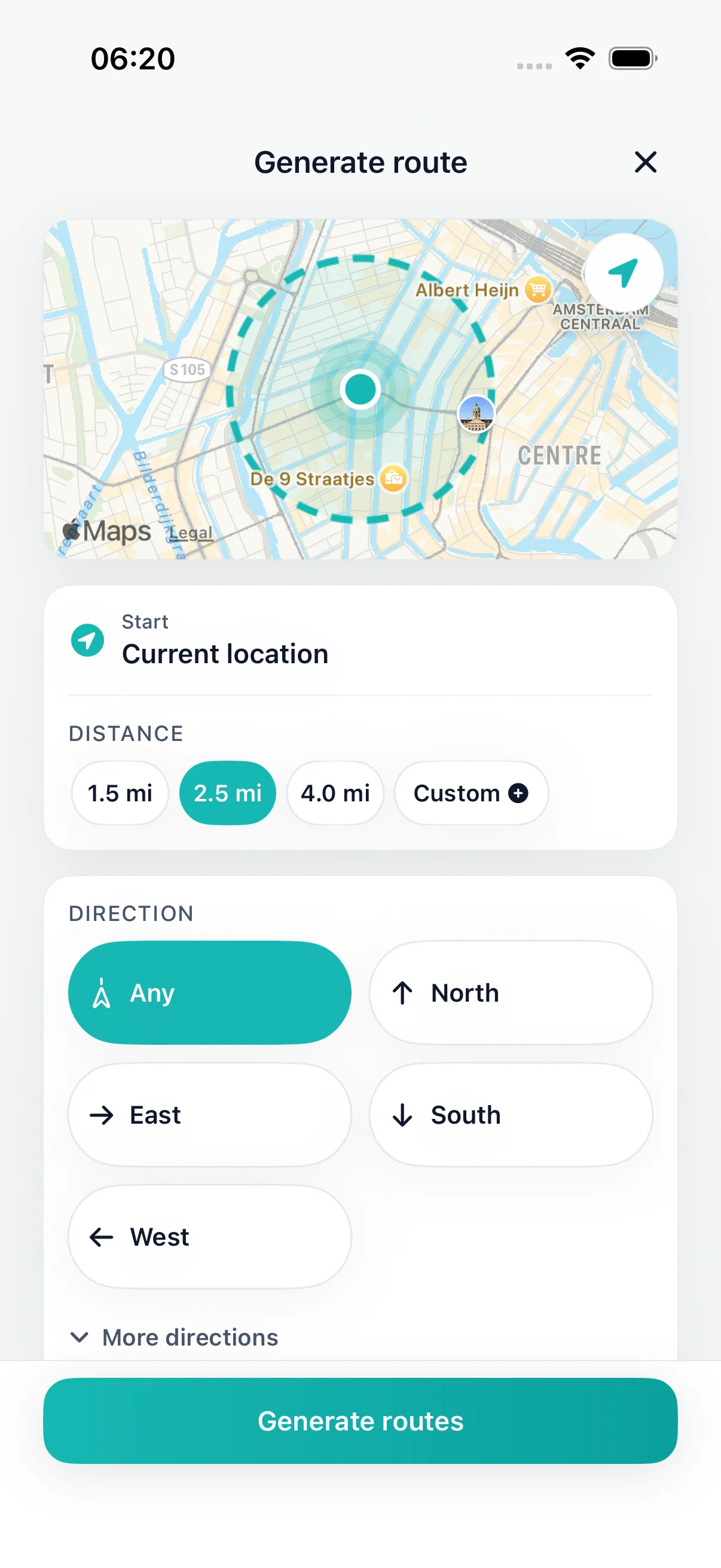
Choose miles or minutes on your iPhone. DailyWander suggests a circular walk from your flat, office, hotel or station, so you finish near where you started. Review the route, crossings and estimated time before you set off.

Download on the App Store Estimate my walking distance

Free on iPhone. Premium is optional.

  • Walking loops on iPhone
  • Choose distance or time
  • Review your route and return point

How far fits your walking time?

Turn your available minutes into an estimated distance, then use the result to choose a loop in DailyWander on iPhone.

Numbers are calculated in your browser. Usage statistics record the mode and pace choice, not the time or distance you enter.

Estimated walking distance

1.5 mi

1.5 mi · 30 min

Shorter distance to leave room for stops
1.3 mi
Calculation
30 min × 4.8 km/h ÷ 60 ÷ 1.609344

Estimates use the selected pace. The steady setting is 4.8 km/h, about 3 mph. The 10% allowance is an example, not a finish-time guarantee; crossings, hills, stops and available paths change a real walk.

From an estimate to a walk you can review

  1. Choose miles or walking time in DailyWander on iPhone.
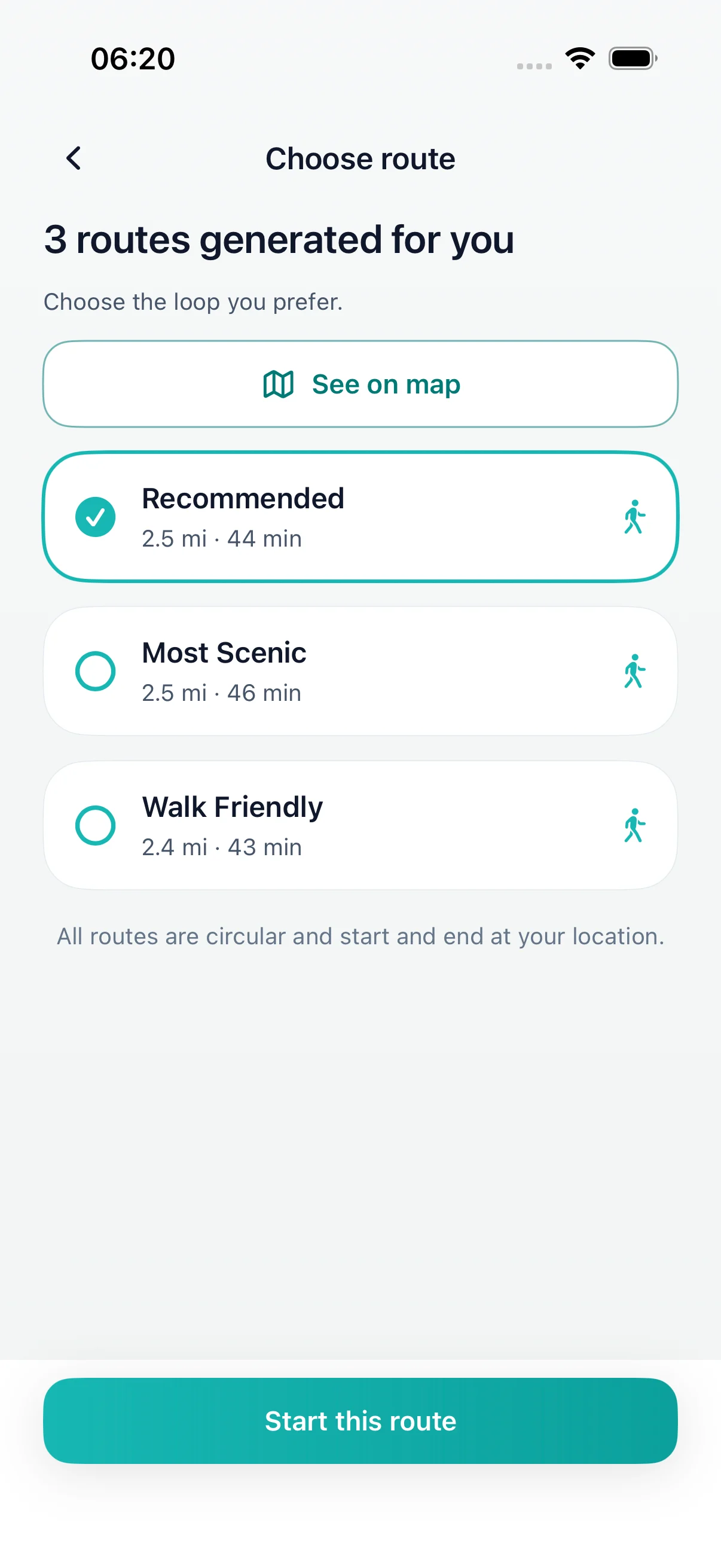
  2. Review the proposed path, crossings, estimated duration and return point.
  3. Start the walk and save the result when you finish.

Enter the distance or time in the app to generate a route. The website estimates numbers; the app creates a separate loop using available walking paths. Comparing three route options requires Premium.

Walking routes in London: where loops work well

You don’t need a named trail to walk in London. Start from where you already are, choose the time you have, and review the suggested loop. These starting points tend to make good everyday walks:

  • The Thames between Westminster and Tower Bridge: start near Waterloo, Embankment or London Bridge and the bridges make it easy to cross the river and come back along the other bank.
  • Regent’s Canal: the canal runs about 8.5 miles (13.7 km) from Little Venice to Limehouse, and the towpath leaves the water briefly at the Islington tunnel. From King’s Cross, Camden or Angel, a loop can follow a stretch of the canal and return through the streets. Towpaths are shared with cyclists, and some sections are narrow.
  • The big parks: Hyde Park and Kensington Gardens join up, Regent’s Park runs into Primrose Hill, and Greenwich Park, Victoria Park, Battersea Park and Hampstead Heath all suit a loop from a nearby station. Many parks lock some gates in the evening, often around dusk, so check opening times before an evening walk.
  • Richmond Park: the Tamsin Trail circles the park in about 7.3 miles (11.8 km) and is shared with cyclists. Plan a shorter loop from one gate if you have less time.
  • Your own neighbourhood: a 30-minute loop from your door through nearby streets is often the easiest walk to repeat every day.

DailyWander does not provide a curated list of London walks or inspect each path. It suggests a new circular route from where you are; check the map, crossings and any closures before you start.
How far can you walk in 30, 45 or 60 minutes in London?

At a steady 4.8 km/h (about 3 mph), these are moving-time estimates. London crossings, busy pavements and station entrances add time, so the shorter targets reserve five minutes for stops.

Example distances at a steady pace
Time availableNo stopsWith 5 minutes reserved
30 minutes1.5 miles1.2 miles
45 minutes2.2 miles2.0 miles
60 minutes3.0 miles2.7 miles

Use the calculator above for your own pace, then enter the time or distance in the app and check the suggested route length.

Before you set off in London

  1. Check the start and return point, especially if you need to be back at a station or office at a set time.
  2. Look at the busy crossings on the map and choose another route if one section doesn’t suit you.
  3. For evening walks, check park opening times and prefer well-lit streets.
  4. Check current closures for towpaths and riverside paths. A line on a map doesn’t confirm that a path is open.

Short on time? Try the lunch-break walk planner or the 30-minute walking guide. Planning a longer loop? See long walks of 5 to 10 miles.

DailyWander

London walking route planner

DailyWander set distance screen

Set distance

Free download on iPhone

DailyWander pick a route screen

Pick a route

Choose distance or time

DailyWander save the walk screen

Save the walk

Compare circular route maps

FAQ

London walking route planner

What are good walking routes in London?

Popular areas include the Thames between Westminster and Tower Bridge, Regent’s Canal, Hyde Park and Kensington Gardens, Regent’s Park and Primrose Hill, Greenwich Park and Hampstead Heath. From wherever you are, DailyWander can suggest a circular walk of the length you choose.

Is there a free walking route planner for London?

DailyWander is free to download on iPhone. Choose a distance or walking time and it suggests a circular walk from your current location in London. Comparing three route options requires Premium.

Can I plan a walk from a London station or hotel?

Yes. Open the app where you are starting, such as a station, office or hotel, and choose miles or minutes. The suggested loop returns near that starting point, which helps when you need to be back for a train or a meeting.

How far can I walk in a London lunch break?

At a steady 3 mph (4.8 km/h), 30 minutes is about 1.5 miles without stops. London crossings and busy pavements slow you down, so reserve five minutes and aim for about 1.2 miles.

Does DailyWander route through parks or along the river?

It builds a loop from available walking paths around your starting point. It does not deliberately choose parks, the Thames Path or canal towpaths, and it does not know park opening times. Check the suggested map, and generate another route if you want a different area.

How long is the Regent’s Canal walk?

The canal runs about 8.5 miles (13.7 km) from Little Venice to Limehouse; the towpath leaves the water briefly at the Islington tunnel. A circular walk usually uses only part of it, leaving the canal at a bridge and returning through the streets.

Can I plan a route between two London addresses?

For directions to a destination, use walking directions in a maps app. DailyWander is made for round walks that finish near your starting point.

Plan a walking route in London from where you are.

Download on the App Store

Walking outside London? Use the UK walking route planner. Visiting another city? Browse city walks.

Plan a London walkFree iPhone download · Premium optional Get