Australia / Brisbane

Follow the Brisbane River. Keep a plan for the way back.

The river makes choosing a direction easy. Choosing a sensible finish takes a little more thought. Compare a short South Bank outing, a section of Riverwalk, and a longer bridge loop before you head out.

By VANTH Studio · Reviewed 6 September 2026

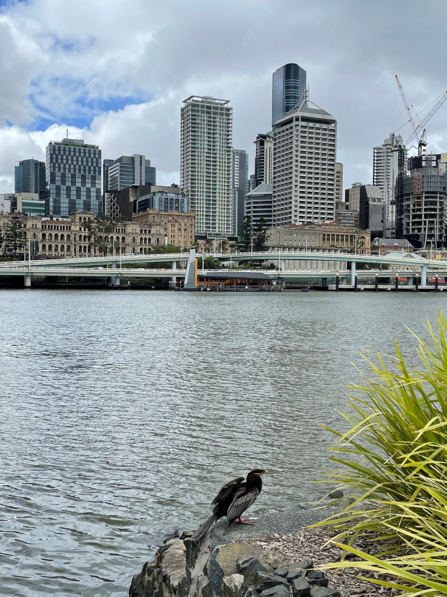
The Brisbane River and city buildings seen from South Bank

Photo: Brisbane River, looking from South Bank Parklands across to the Brisbane CBD and Riverside Expressway, 2021 — Anonymous · CC BY 4.0. Illustrative photograph; display crop.

How much time do you have?

Use these as starting ideas. Planning windows exclude travel to the start, and allow different amounts of stopping time. For a named trail, follow the operator’s guidance. A short park visit does not mean completing its entire perimeter.

Options to consider: 3. Check the return plan and current access before choosing.

01

The Arbour at South Bank

Short linear promenadeAbout 1 km along the ArbourPlan 30–45 min including a return

Why choose it. A useful first choice when you want a short walk within one precinct. Visit Brisbane describes the Arbour as a kilometre-long structure through South Bank, with bougainvillea overhead.

Do not count the Arbour’s length as the distance of a complete loop. Walking the whole length and back is roughly 2 km before diversions. Start a smaller section if you only have a brief break.

Starting area
A chosen entrance to South Bank Parklands
Return plan
Return along the section you walked; riverside and garden detours add distance.
02

A short section of Brisbane Riverwalk

Adaptable out-and-backChoose a section; full QUT–New Farm route is 5 km one wayPlan 45–60 min for a partial walk

Why choose it. Choose this to spend time beside the river without attempting the whole corridor. Brisbane City Council describes a 5 km QUT-to-New Farm route through Howard Smith Wharves.

Our shorter suggestion is only part of that route: walk from the wharves towards New Farm and turn back with time in hand. If you instead walk the complete 5 km corridor, allow much longer and arrange the return independently.

Starting area
Howard Smith Wharves, heading towards New Farm
Return plan
Turn back on your chosen section; the entire city-to-New Farm route is not a short loop.
03

Neville Bonner Bridge–Kangaroo Point Bridge loop

Bridge loopAbout 6 kmPlan 90–120 min with pauses

Why choose it. Choose this for a longer city walk that uses the river crossings as part of the experience. Visit Brisbane lists a six-kilometre loop joining the Neville Bonner and Kangaroo Point bridges.

Six kilometres is about 75 moving minutes at 4.8 km/h, before stops and approach time. Follow the publisher’s route details and check bridge/path access before leaving; do not improvise a shorter river crossing from a straight-line map.

Starting area
Neville Bonner Bridge, following the published loop
Return plan
The published itinerary returns around the river via the bridges.

A ferry return is a transport plan, not a walking shortcut.

Brisbane’s river bends make straight-line distances misleading. Two places that look close across the water may require a bridge detour. If you plan a one-way walk, check the current CityCat or other transport connection before committing to it. For a tight time window, walking out and back along a short section is easier to judge than adding an unfamiliar bridge. Take pauses and conditions into account; these are planning suggestions, not guaranteed completion times.

Want a different loop from where you are?

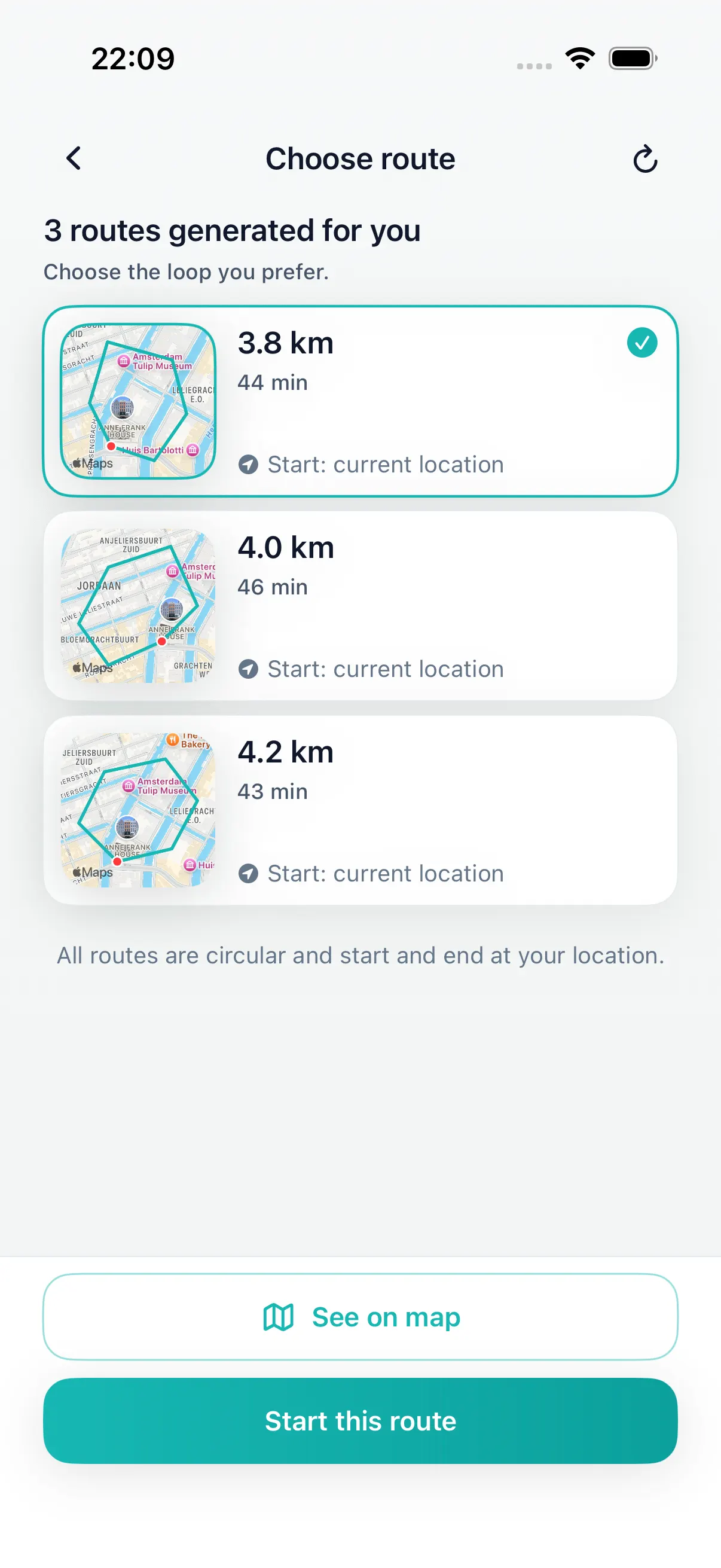
Open DailyWander on iPhone, choose distance or walking time, and review a proposed circular walk. The app generates its own route from available paths; it does not automatically recreate the published walks above.

Distance and time are estimates. Review the path, crossings and return point. Comparing three route options requires Premium.

DailyWander · km
Example app route choices in kilometres. Demo routes do not depict this city guide.

Before you go

Can I make every option a 30-minute loop?

No. Some options are linear, some are longer circuits and others are flexible visits. Use the return plan on each card. A calculator does not turn a one-way walk into a loop.

Will DailyWander open these exact routes?

No. This guide helps you choose an outing. DailyWander creates separate route suggestions from your chosen location and preferences; review those independently.

How to use this guide

These are editorial walking suggestions researched from the linked sources, not GPS tracks recorded by our team. Published distances are labelled; flexible visits have no invented precise distance. Where we calculate moving time, we use 4.8 km/h before stops. Check the operator’s latest notices, signs and local conditions. No route is certified here as step-free or suitable for every walker.

More places to walk