7 Scenic Walking Routes in Dutch Limburg (2025 Local's Guide)

Note: This guide focuses on Dutch Limburg in the Netherlands, not Belgian Limburg.
I may live in Dutch Limburg, but most of my walking life plays out on its trails, dunes, and rivers rather than behind a laptop. The province stretches from the urban buzz of Maastricht to the forest ridges near Germany, which means you can squeeze a weekend getaway feeling into a 90-minute walk. These are the routes I keep coming back to when friends ask, “What should we walk this weekend?”
Start Your Limburg Walk in 30 Seconds
Open DailyWander, choose your distance, and instantly generate a circular route near Maastricht, Roermond, Heerlen, or wherever you are staying.
Get DailyWander on iPhoneFree download • 3-day premium trial
March–June for blossoms and September–October for golden light. Summer weekends are gorgeous but busier around Maastricht.
Bring your OV-chipkaart. Most routes start near stations (Maastricht, Sittard, Roermond) or bus hubs.
Knooppunt markers cover every route here. Save the node numbers in your phone or DailyWander so you can improvise.
1. Maastricht River Promenade + St. Pietersberg Loop
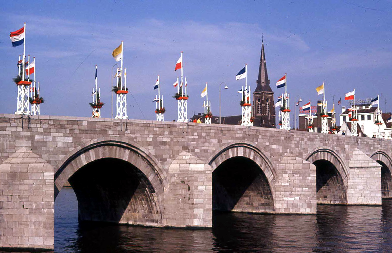
Distance: 8.5 km • Start: Plein 1992 • Highlights: Maas skyline, Hoge Brug, limestone quarry viewpoints.
Start at the Wyck side of the city, cross the Hoge Brug, and follow the Maas upstream. Once you hit the Sint Servaas bridge, duck into the Jekerkwartier streets before climbing toward St. Pietersberg. The limestone ridgeline delivers a full panorama of Maastricht, Belgium, and rural Limburg in one glance. I like finishing with vlaai at Café Zuid before hopping on the train.
2. De Meinweg Ridge Traverse

Distance: 13 km • Start: Station Herkenbosch (bus stop) • Highlights: Boardwalks, heath, German border viewpoints.
Meinweg is the only place in the Netherlands where the land drops into literal terraces. Leave the visitor center on the ridge trail toward Rolvennen, cut across the heath via the wooden boardwalks, then swing south along the border path to the viewing tower before looping back through the pine forest. Bring snacks; facilities are limited once you leave the visitor center.
3. Thorn "White Village" Heritage Walk

Distance: 6 km • Start: Thorn center • Highlights: Whitewashed houses, Maasplassen shoreline, local bakeries.
Thorn was once a mini-principality run by abbesses, which explains the white facades and convent-like calm. Follow the cobblestone streets toward the Maasplassen lake district, loop past the chapel of Schurenberg, and swing back via the Kessenicherweg towpath. It’s short, but pairing it with a sunset picnic near the water makes it feel like a mini-vacation.
4. Nationaal Park De Maasduinen Dune Trail

Distance: 14 km • Start: Wellseind visitor center • Highlights: Longest river dunes in the country, mirror lakes, nightjar habitat.
Maasduinen runs parallel to the German border and feels completely different from the rest of Limburg. Sand ridges roll between pine forest and peat lakes, so you’re constantly switching surfaces. I map out a figure-eight loop around Reindersmeer - one of the clearest lakes in the Netherlands - then continue toward the Bergerheide for golden-hour light.
5. Sittard City Walls & Kollenberg Pilgrimage

Distance: 9 km • Start: Sittard station • Highlights: Medieval wall, vineyard slope, basilica bells.
Sittard is tiny but layered. Start with a loop of the intact city walls, pass the Dominicanen monastery, then climb the Kollenberg hill via the Stations of the Cross path. It tops out at a chapel with sweeping views over the Geleen valley. Add the Ophovenermolen watermill if you want a coffee stop with terrace seating.
6. Vijlenerbos Ridge to Three-Border Point

Distance: 12 km • Start: Café Modern, Vijlen • Highlights: Highest forest in the Netherlands, Belgium/Germany border marker, rolling farmland.
The Vijlenerbos gets called “Little Ardennes” for a reason. The trails actually undulate, which is rare in the Netherlands. I climb out of Vijlen via the Panoramaweg, follow the marked ridge track toward the Drielandenpunt tower, then descend through the meadows filled with half-timbered farmhouses toward Camerig. Stop at Boscafé ’t Hijgend Hert for local beer before the final descent.
7. Green Mine Trail Heerlen

Distance: 10 km • Start: Heerlen station • Highlights: Urban art, rewilded slag heaps, cultural hotspots.
Heerlen reinvented its mining past with creative trails over former slag heaps. The Green Mine route strings together murals, sculpture gardens, and the carbon-neutral Maankwartier district. It’s the walk I suggest when friends want something urban but still green. Expect a mix of stair climbs and gentle ramps as you crest the old mining hills.
Route Planning Cheat Sheet
Prefer a one-glance overview? Bookmark this table before you lace up.
| Route | Distance | Surface | Best for |
|---|---|---|---|
| Maastricht Promenade | 8.5 km | Paved + limestone | City + hill views |
| De Meinweg | 13 km | Forest, boardwalk | Long nature loop |
| Thorn Heritage | 6 km | Cobblestone, gravel | Short day trip |
| Maasduinen | 14 km | Sand, pine needles | Wild landscapes |
| Sittard & Kollenberg | 9 km | Paved, hill trail | Culture + climb |
| Vijlenerbos Ridge | 12 km | Forest singletrack | Border adventure |
| Green Mine Heerlen | 10 km | Paved + park paths | Urban creativity |
Local etiquette: keep dogs on a leash during lambing season (Feb–Apr), and always share forest tracks with cyclists - it’s a Dutch thing.
Turn These Routes Into Daily Loops
If you found this guide through searches for Limburg walking routes, this is the fastest way to move from ideas to action:
- Pick 3 km, 5 km, or 8 km in DailyWander.
- Start from your hotel, train station, or city center.
- Use shuffle until the loop matches your mood and terrain.
- Save your favorite Limburg loops for future weekends.
Generate a Fresh Limburg Route Now
DailyWander creates circular walking routes in seconds so you spend time walking, not planning.
Download on the App StoreWhat to Pack for a Limburg Walk
- Waterproof layer - the weather changes fast near the river plains.
- OV-chipkaart or bank card for Arriva buses. Drivers rarely accept cash.
- Offline map with Knooppunt numbers in case a signpost disappears.
- Small tote for bringing home vlaai, local cheese, or craft beer (trust me).
Make It a Habit with DailyWander
I log every one of these routes inside DailyWander so I can remix them quickly: shorter midweek loops, longer weekend explorations, and "show a friend the highlights" mash-ups. Add them to your Collections, set a reminder, and the app will nudge you the moment the weather clears. Limburg is compact, so a good idea - and a train ticket - is all you need.
Frequently Asked Questions
Is Limburg good for hiking?
Yes, Limburg is excellent for hiking. It's the only Dutch province with real hills, offering diverse terrain from river promenades and limestone ridges to forest trails and sand dunes. The well-marked Knooppunt trail network makes navigation easy, and you'll find routes for all fitness levels.
What is the best area to walk in Limburg Netherlands?
The South Limburg hills around Vijlen and Vaals offer the most dramatic scenery with rolling farmland and forest ridges. For river views, try Maastricht's St. Pietersberg loop. Nature lovers should explore De Meinweg National Park or De Maasduinen for unique landscapes.
Are there hills in the Netherlands for walking?
Yes, Limburg in the southeast has the Netherlands' only significant hills. The Vaalserberg near the German border reaches 322 meters, the country's highest point. The Vijlenerbos forest and St. Pietersberg near Maastricht offer genuine climbs with rewarding views.
How do I navigate hiking trails in Limburg?
Limburg uses the Knooppunt (junction) system. Numbered posts mark intersections throughout the trail network. Plan your route by noting the node numbers in sequence, then follow the signs between points. Save your route in DailyWander or take a photo of the junction map at trailheads.
What is the Drielandenpunt (Three-Border Point)?
The Drielandenpunt is where the Netherlands, Belgium, and Germany meet at a single point near Vaals. At 322 meters, it's also the highest point in the Netherlands. A viewing tower and border markers make it a popular destination, easily reached via the Vijlenerbos ridge trail.
What should I bring for a walk in Limburg?
Bring a waterproof layer (weather changes fast near the rivers), an OV-chipkaart or bank card for buses, an offline map with Knooppunt numbers, and a small tote for bringing home local vlaai, cheese, or craft beer. Sturdy walking shoes are recommended for forest and hill trails.
Discover New Walking Routes in Limburg
DailyWander generates fresh circular walking routes in Limburg and regions worldwide. Track your hikes and explore like a local, every day.
Download on the App StoreImage credits
Images sourced from Wikimedia Commons; authors and licenses listed below.
- Eijswkped06.JPG — Els Diederen at li.wikipedia — CC BY-SA 3.0
- Maastricht,_Sint_Servaasbrug,_GAM_36201.jpg — Unknown photographer (Fotografische Dienst Gemeente Maastricht) — CC BY 4.0
- Abendpanorama_im_Nationalpark_De_Meinweg_1.jpg — VinceLe — CC BY-SA 4.0
- Hofstraat_Thorn.jpg — Alupus — CC BY-SA 3.0
- Nationaal_Park_De_Maasduinen_(32).JPG — Campinia88 — CC BY-SA 4.0
- Sittard,_de_Markt_met_diverse_monumentale_panden_en_de_Sint-Petrus'_Stoel_van_Antiochiëkerk_op_de_achtergrond_IMG_8193_2021-02-21_09.47.jpg — Michielverbeek — CC BY-SA 4.0
- Epen-Vijlenerbos_(2).jpg — Romaine — CC0
- Heerlen_Pancratiusplein.jpg — Choinowski — CC BY-SA 4.0
About the author: VANTH Studio has hiked countless kilometers through Limburg's rolling hills. VANTH Studio created DailyWander to help others discover the hidden gems in their favorite regions.